 |
SASAR VHF Imagery
|
The signal processing for the system is performed using the G2 SAR Processor,
developed over a number of years at the UCT
RRSG. This fully motion-compensated, airborne SAR processor is based
on the range-Doppler algorithm with the main modules written in C and using
Python
as the glue language.
Our analysis and simulation has shown that the range-Doppler approach
provides good quality imagery for the modest resolution requirements of
the current SASAR VHF system. In addition, we have developed an efficient
extension to range-Doppler processing which allows for higher resolution
processing at VHF, although this is not required for operational use of
the current system. Other approaches suitable to high resolution,
low frequency processing include the range migration approach and the time
domain approaches traditionally requiring more computation, but allowing
for a more natural wide-beam motion compensation implementation.
When processing multiple images with the G2 processor, efficient use
is made of our parallel cluster, Gollach,
using the Mosix extension of the Linux kernel. In addition, efforts are
underway to produce a parallel version of G2 using PVM (Parallel Virtual
Machine) which will speed up the processing of individual SASAR images.
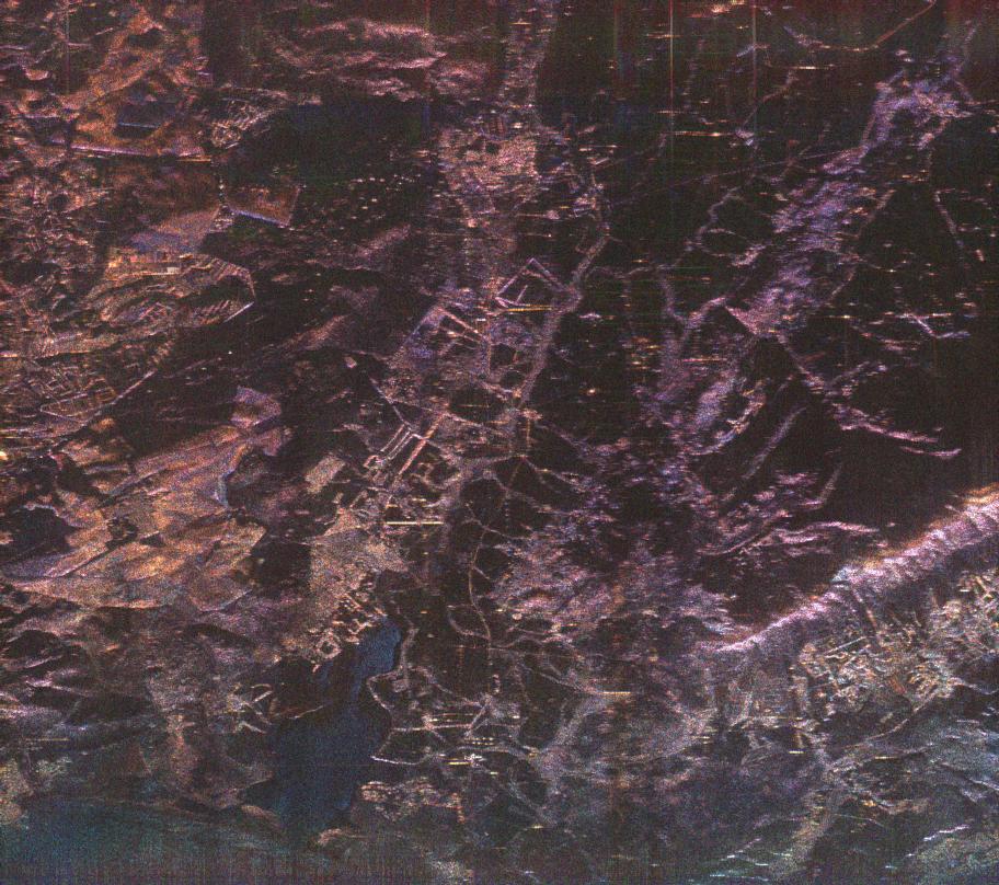
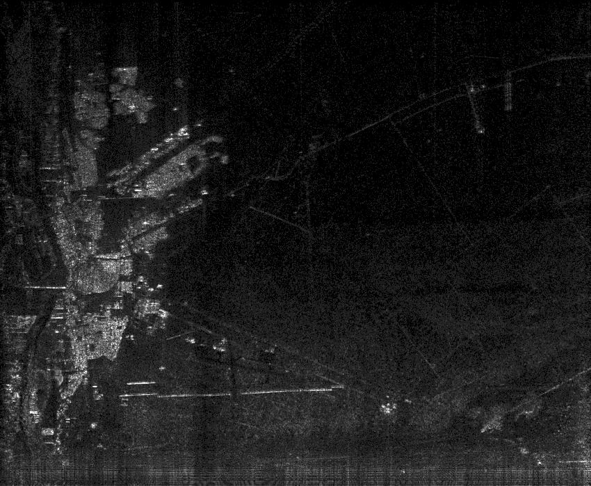
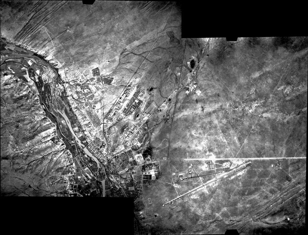
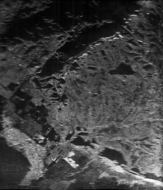
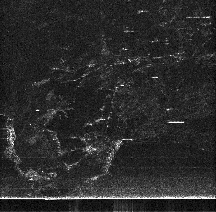
Hermanus, South Africa 1999-11-29 (Latest!)
These runs were along the Southern coast of South Africa in the Hermanus
area near Cape Town.
-
RGB polarimetric colour composite
: The radar is right looking with azimuth horizontal and far (slant) range
at top. Resolution is approximately 12m in each direction and the image
dimensions are approximately 23 km azimuth by 20 km range. The Botrivier
Vlei (lagoon) may be seen as the extended blue feature at the bottom with
extended mountainous and forested regions also visible. The vertical linear
features at the top are artifacts of the interference suppression algorithm.
The three bands have been processed to single look and are displayed as
4th root of power (due to the very large image dynamic range, typical of
VHF imaging).
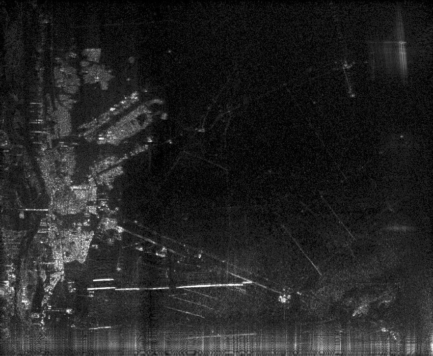
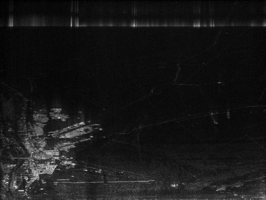
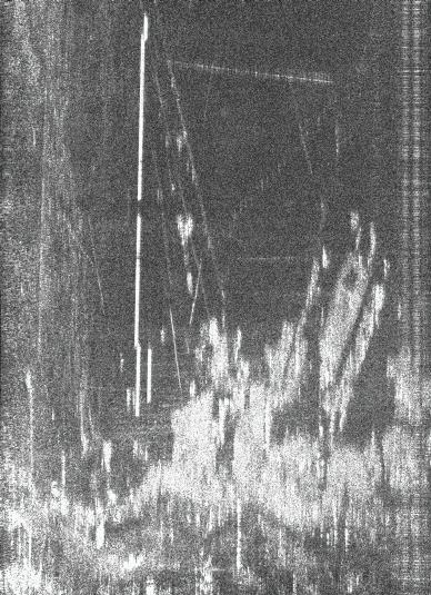
Upington, South Africa 1999-09-02
All images with motion compensation using IMU and DGPS, unless specified.
These images display good focus. The town of Upington may be seen as the
bright region to the left of the image. The regions away from the town
have very low radar backscatter at SASAR frequencies and correspond to
flat, unvegetated, desert regions. The bright, horizontal feature near
the base of the image is the airport fence. Other fence structures are
also visible as bright linear features.
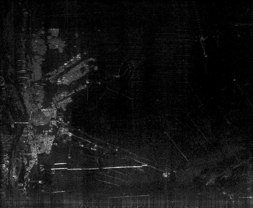
Upington, South Africa 1999-09-04 (Interferometry)
A number of runs at different heights were performed. This allowed for
some repeat-pass interferometric processing to be performed.
Note that these results are very preliminary. Improvements to the image
registration algorithm should improve the results. In addition, the Upington
scene is not well suited to intereferometry due to the extremely low backscatter
from the flat, unvegetated desert surrounds. The town areas and fences
provide the regions of highest coherence. The processing was performed
on VV data. Note that the radar was not performing as well on this day
as for the 1999-09-02 images. Note also that no correction has been made
in these images for the tracks not being accurately parallel.
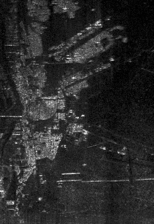
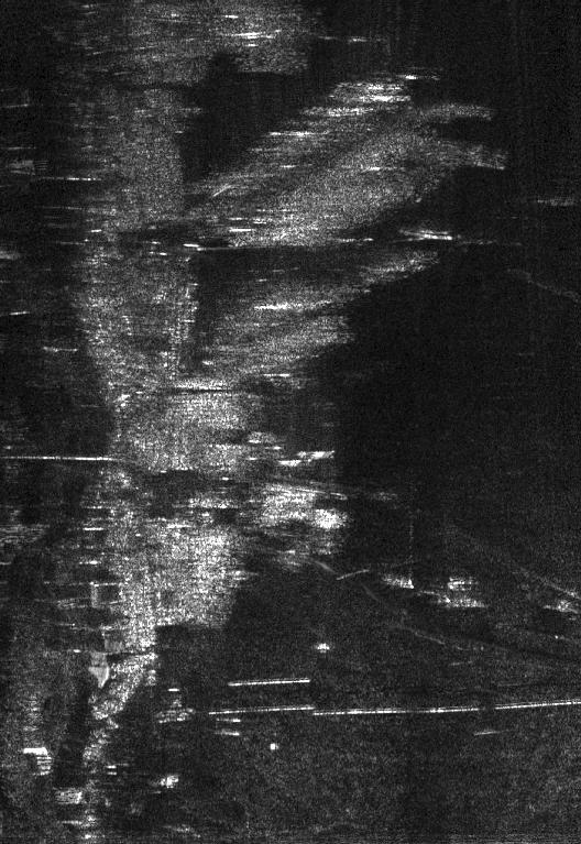
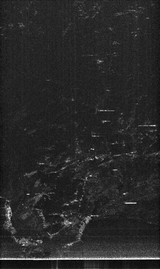
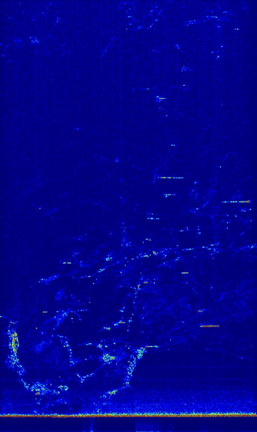
Tzaneen, South Africa 1999-07-21
This is a forested and mountainous area. Returns are seen right to the
far swath (24 km). During these flights a number of problems with the radar
were encountered, but some interesting imagery was still obtained. These
are the first flights where the DGPS and pulse expander were used.
-
VV polarization in Tzaneen area
and text descriptor file. The
dark vertical bands in the image are due to partial dropouts in the radar.
The bright band at far range is due to a glitch in the recording system.
-
VV polarizarion on return flight
and text descriptor file. Note
that the image displayed is only a subsection of that described in the
descriptor file. The focus is not sharp for parts of the image due to an
intermittent problem in the radar.
Flight from Pretoria to Cape Town 1999-01-15 (historical interest only)
Inertial data available in two dimensions (no height change data). No DGPS
available and monochromatic pulses used. Smooth conditions reported on
flight. Click here
for a map of the flight path for the data recorded during the flight.
On-line images (preliminary - no fine tuning performed)
In all images, the pixels are approximately square, slant range is displayed
with near range at bottom. The flight direction (azimuth) is from right
to left (as if looking out of the window for the right-looking antenna).
Unless indicated, no motion compensation has been applied.
In many images, the bright horizontal line near the bottom is the nadir
return and faint repeated horizontal lines are artifacts of the interference
suppression caused by processing of the nadir return. Interference shows
up as bright vertical lines. Short, bright horizontal lines in some images
are thought to be man-made linear structures whose orientation happens
to be parallel to the flight path (some ground truth work to follow...).
-
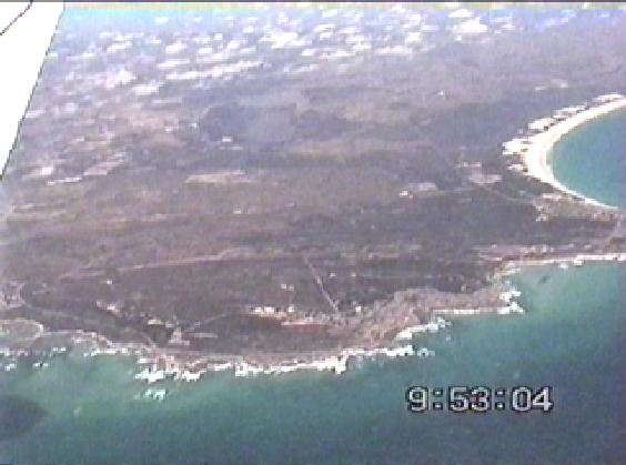
Gansbaai area (data take ivh06.000) Click here
for map of the flight path.
-
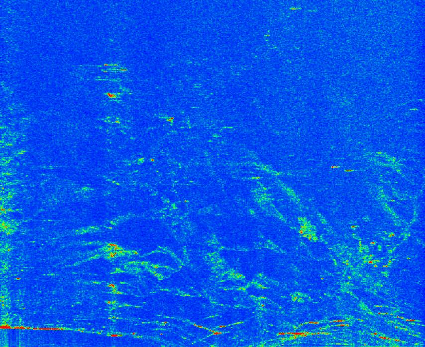
HH image 13 km
in azimuth extent, 24 km in range extent, long pulse (75 m range resolution),
4 looks, first order motion comp, LMS interference suppression. Also, colour
version and zoomed in near
range of same image. This displays improved SNR due to the long pulse
used.
-
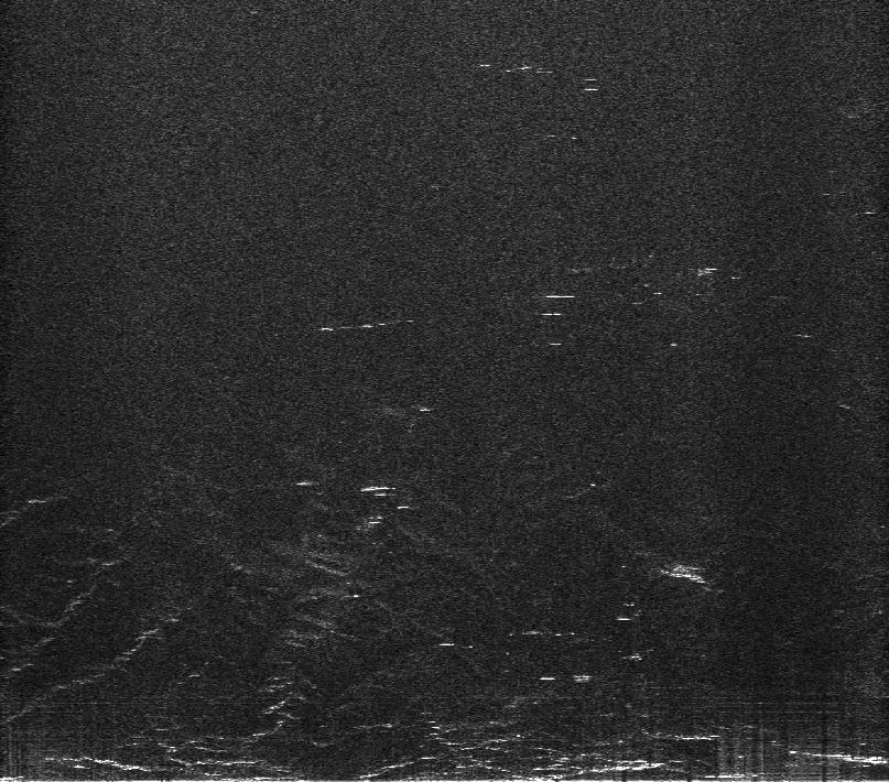
HH image
13 km in azimuth extent. No interference suppression.
-
Cape Agulhas area (data take ivh02.006). Click here
for map of the flight path. Also available: video
pan image of area (53 KB) and 3 video frames (frame1,
frame2,
frame3
- each approx 34 KB)
-
HH image
13 km azimuth extent, with LMS interference suppression, 4 looks, 25 m
range resolution, 17 m nominal azimuth resolution, skipping nadir return.
-
VV image
with LMS interference suppression.
-
HH image
12.5 km (azimuth) without interference suppression.
-
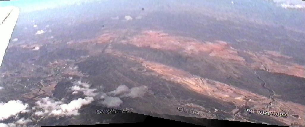
Outeniekwa area (data take ivh02.003). Click here
for map of the flight path. Also available: video
pan image of area (56 kB) and avi
format video clip (3.1 MB).
-
HH image
with notch filter for interference suppression. Colour
version also available.
-
HH image
20 km in azimuth extent. No interference suppression.
-
Kammanasie area (data take ivh01.001). Click here
for map of the flight path.
-
HH image 13 km in azimuth
extent, 12 km slant range extent, 4 looks, first order motion comp, LMS
intereference suppression., short pulse (12.5 m range resolution) hence
low SNR.
-
HH image
17 km in azimuth extent. No interference suppression.
Flight North of Pretoria 1999-01-13 (historical interest only)
First radiating flight, 1999-01-13, area north of Cullinan mine, very rough
conditions, no inertial data available. No DGPS available and monochromatic
pulses used. The on-line images have the following parameters:
-
Data take: ivh01-h6
-
Polarization: HH
-
Motion compensation: none
-
Nominal resolution: 12m range and 20 m azimuth
-
Image dimensions: approx. 12 km slant range by approx. 3 km azimuth
-
Images have been subsampled and smoothed and have xv gamma correction of
2. The bright targets easily saturate the image dynamic range.
On-line images (note very preliminary - no fine tuning of the processing
applied):
-
No interference suppression here.
-
64-notch interference suppression filter here.
-
Least mean squares adaptive interference suppression filter here.
Enquiries / suggestions
about this site or the SASAR system and signal processing.
Up to SASAR home page
This page last updated by tb
2005-07-07 (C) UCT 1999-2000